


LOUISIANA, Mo. • Residents of the towns and farms between Hannibal and 51���� are known for coming together to fight the Mississippi River’s attempts to reclaim its floodplain.
But the stories of sandbagging and cooperation belie a simmering distrust among some of those who make their homes along the river.
Mark Harvey, superintendent of Pike County R-III School District, believes property in his district has been taking more than its fair share of floodwater, pushed there illegally by a levee district driven by “nothing more than greed.”
He and other Pike County, Mo., residents point to the farmers who till the fertile floodplain across the river in Illinois, protected for some 60 miles by the . Stretching from south of Quincy, Ill., to Belleview, the almost entirely agricultural levee district is the largest overseen by the .
People are also reading…
And for years, many Sny district levees have been higher than federal law allows, the corps says, which could worsen floods on the more populous Missouri side of the river.
It’s something residents on the Missouri side have suspected for years, but the corps only earlier this month confirmed it agreed with them by taking punitive action. The corps says the Sny district has added three to four feet to the height of most of its levees without approval, an addition it estimates could add several feet of floodwater to some locations across the river.
“They’re saying our land, our commerce, our crops are more valuable than yours are,” Al Murry, Pike County’s emergency management coordinator and floodplain manager, said of the Sny district.
There’s a bigger issue, said , a professor at the University of California-Davis who is familiar with local floodplain issues from his years as a professor at Southern Illinois University-Carbondale.
“The broader thing here is a lot of these levee districts manage their floodplains with impunity,” he said.
While the Sny district denies it has raised its levee heights, river experts say it and other levee districts appear to be flouting rules meant to more equitably manage the Mississippi. And the effects could go beyond river hamlets like Clarksville and Hannibal.
“We do have a general sense that this is very, very common on the Mississippi River, especially between Illinois and Missouri north of 51����,” said Olivia Dorothy, associate director of Mississippi River management at advocacy group . “It’s impossible to say that the actions of the Sny levees alone are impacting flood levels in 51����, but I would say it’s likely that the combined impact of all these levee districts taking all of these types of actions might be impacting flood levels around 51����.”
‘FUNDAMENTAL DISAGREEMENT’
During a 500-year flood (which has a 0.2 percent chance of occurring annually, or once every 500 years), the additions to the Sny levees could push an additional 2.5 feet of water onto some communities between Keokuk, Iowa, and Grafton, the corps estimates. That includes the Missouri counties of Marion, Pike, Lincoln and St. Charles.
Rock Island District corps spokesman Ron Fournier said the calculations were still being vetted and he couldn’t release the Sny district’s impact on specific flood impacts at specific locations. He added that the corps has not yet “fully defined” the entire risk area to model whether there are any impacts on 51����.
For years, Fournier said corps officials have told the Sny district to return the levees to their authorized heights, which were intended to protect the 115,000 acres and roughly 1,200 residents from a 50-year flood.
“Years went by and years went by, and we decided it was time to take action because nothing was happening,” Fournier said.
Earlier this month, the corps sent the Sny district a letter stating that it was no longer eligible for federal funds that go to repair levees after a flood.

Some Pike County residents say the light brown area on the levee to the right shows how high it was raised several years ago. The levee is part of the Sny Levee and Drainage District on the Illinois side of the Mississippi River across from Louisiana, Mo., shown here on Tuesday, Sept. 15, 2015. Photo by J.B. Forbes, jforbes@post-dispatch.com
Mike Reed, the Sny district’s superintendent, disputes that the levees were raised above authorized levels. And it took down additions it added during the 2008 flood-fighting effort, he said.
“We just have a fundamental disagreement with the corps,” Reed said. “The levee elevations down in those areas haven’t changed since they were constructed in the 1960s.”
Reed points out that since 2003, the district has been public about its 100-year flood protection accreditation from the Federal Emergency Management Association. That means the farmers it protects aren’t required to buy flood insurance, and premiums can be lower for those who do.
The corps knew that the levees were large enough to win the district 100-year accreditation back then, Reed said, because corps engineers helped them get it.
“It’s hard for us to imagine how they can have that opinion when they assisted us in getting that,” Reed said.
Fournier acknowledged that corps engineers were contracted to verify that the Sny district levees were high enough to meet FEMA’s standards for 100-year protection. But that doesn’t mean the corps agreed they were authorized to do it.
“That’s what we were paid to do and that’s what we did,” he said. “We never concurred that their levee heights were authorized, and that was not part of the question either.”
A FEMA representative said the documentation the agency received from the Sny district in 2003 appeared to meet their requirements and was sealed by professional engineers.
“We had nothing to suggest there was anything not meeting those standards or inappropriate,” said Eric Kuklewski, the risk analysis branch chief for the FEMA regional office covering Illinois.
FEMA will review any new information, including whether the Sny district has the required permits, that is made available, he said.
‘YOU DON’T SEND IT TO YOUR NEIGHBORS’
Pike County, Mo., residents say they can tell the Sny district’s levees are too big just by looking at them.
“They make our levees down around Kissinger (Levee System) look miniscule,” said Pike County’s Eastern Commissioner, Curt Mitchell. “You’re fighting a giant here when you’re trying to protect your property.”
On a recent tour of some levees in the Sny district, local resident Nancy Guyton pointed to the clusters of grain bins built in the middle of the vast valley behind the levees. Farmers don’t put grain bins anywhere with a risk of flooding, said Guyton, whose husband’s family has farmed on the Missouri side of the river for four generations.

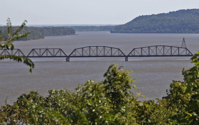
Kate Oliver, 2, swings in Henderson Park in Louisiana, Mo., on Tuesday, Sept. 15, 2015. Below is the old Champ Clark Bridge that connects Louisiana with Illinois. The bridge is impassable during Mississippi River flooding since the levee is further east than the end of the bridge. Kate's mother, Jo Ann Oliver, from Louisiana, was pushing the swing. Photo by J.B. Forbes, jforbes@post-dispatch.com
“You just see this for miles and miles and miles,” she said, pointing to the tall, sandy levees just across the Champ Clark Bridge from Louisiana, Mo. “And it’s all in violation.”
Not since 1993 have any of the Sny district levees failed, Reed, the district’s superintendent, said. Then, the northern 40 percent of the levee system failed.
“The rest of the district hasn’t flooded since the early 1900s,” he said. “That’s what we were supposed to do. That’s what the system was put in place for.”
But Guyton says a mostly agricultural area like the Sny district shouldn’t have levees as high as 100-year protection. Those heights should be reserved for towns. And, she said, they shouldn’t flout river regulators.
“I just think people need to follow the law,” Guyton said. “My husband farms along the river and he takes his licks. ... You do what you can to fight it, but you don’t send it to your neighbors.”
The biggest impact appears to be at Hannibal, said Pinter, the UC Davis professor. Without the Sny district, he calculated flood heights in Mark Twain’s hometown would be 5 to 7 feet less. That doesn’t include the increases allegedly added by the Sny district.
“It’s such a broad floodplain so that the Sny levees create a relative chokehold at that location, and the second issue is that chokehold coincides with the city of Hannibal,” Pinter said. “What we’ve said all along is that Hannibal and its residents should be particularly concerned.”
The places in Hannibal that sit in the flood plain include historical sites that many in the Show-Me state hold dear. Hannibal built a 500-year floodwall just in time to stave off the flood of 1993, said former mayor John Lyng.
“In ’93, without that flood wall, water would have been just up to your knees in the parlor of Mark Twain’s boyhood home,” he said.
But, while he’s concerned, Lyng said no one else seems to realize the Sny district’s potential impact on Hannibal. The city manager confirmed as much.
“It hasn’t been on our radar,” said Hannibal city manager Jeff LaGarce. “We trust the corps will do their job.”
Reed maintained the Sny district hasn’t raised its levees or adversely impacted its neighbors.
“We don’t feel we increased any floodwaters on our neighbors,” Reed said. “The only time we increased heights was under the authority of the corps to do pushups during the great flood of 1993 and 2008.”
Asked whether an agricultural levee should even provide 100-year protection in the first place, Reed didn’t answer directly. But he did say the Sny district has followed the law as it existed, and other levee districts across the river have every right to do the same.
“We followed the processes that were in place by the Corps of Engineers at the time, and that’s what we did and that’s what it was and everyone else has the same opportunity to do that,” he said.
EVERY COMMUNITY’S CONCERN
Whether the loss of future federal flood repair funding will induce the Sny district to take down levees to heights the corps wants is unknown.
Fournier, at the corps, said the Sny district could apply for a permit to raise the levees. But it could be “difficult,” he said, because the Sny district would have to quantify the impacts to other river communities and develop a plan to mitigate them.

Farmer William Harris Guyton, 71, harvests his corn on his river bottom land east of Annada, Mo., on Tuesday, Sept. 15, 2015. The last time his property was flooded was by the Mississippi River water topping the levees in 2008. Photo by J.B. Forbes, jforbes@post-dispatch.com
Reed says the Sny district doesn’t plan to apply for a permit, which can cost hundreds of thousands of dollars.
Dorothy, at American Rivers, worries it might just keep the levees too high. It’s her understanding the Sny district has a “substantial” bank account, and the loss of federal flood repair funding may not have enough bite.
“It’s not likely they would really need that funding in the future,” she said. “If they didn’t receive it, I don’t think it would break them.”
The Illinois Department of Natural Resources has gotten involved, citing the Sny district for working in a floodplain without a permit. But the penalty is only $1,000 in all. That rises to $5,000 on Jan. 1, said Regulatory Programs Section Manager Mike Diedrichsen. The Illinois regulators plan to meet with Sny district officials in the next couple of months to determine the next steps, he said.
The corps could also refer the matter to the U.S. Department of Justice if it doesn’t resolve its dispute with the Sny district, but it’s not “going to go out there and start tearing levees down,” Fournier said.
A more effective deterrent would be revoking a district’s FEMA accreditation, Dorothy said. That would remove the incentive of lower flood insurance premiums. But she said she’s never heard of FEMA revoking accreditation because of impacts downstream.
Whether the Sny district complies, Dorothy stressed, should be the concern of every Mississippi River community.
“If one levee district is allowed to get away with it, then all the levee districts are going to be able to get away with it.”